| Name | Beechgrove Beach | ||
| Location | Scarborough, Toronto, Ontario, Canada | ||
| GPS | 43.7640N, 79.1482W Aboulder embankment, east end of East Point Park boulder embankment |
43.7592N, 79.1530W Cbend of shoreline, 300 meters southwest of point of access bend of shoreline |
|
| 43.7614N, 79.1505W Bpoint of beach access next to culvert, 350 meters southwest of boulder embankment point of beach access |
43.7556N, 79.1707W Dstream mouth west of East Point Park, 1.5 kilometers west of bend of shoreline stream mouth |
||
| The four locations pinpointed above are listed from east to west. The distance from Aboulder embankment, east end of East Point Park to Dstream mouth west of East Point Park, 1.5 kilometers west of bend of shoreline is about 2.2 kilometers, roughly corresponding to the boundaries of East Point Park. Point Bpoint of beach access next to culvert, 350 meters southwest of boulder embankment is the only easy point of access to the beach. Nude bathing is customary beginning around the bend of the shoreline (point Cbend of shoreline, 300 meters southwest of point of access ), extending westward approximately to the stream mouth (point Dstream mouth west of East Point Park, 1.5 kilometers west of bend of shoreline ). Nudity also occurs near point Aboulder embankment, east end of East Point Park , especially when the Cbend of shoreline, 300 meters southwest of point of access to Dstream mouth west of East Point Park, 1.5 kilometers west of bend of shoreline expanse is inaccessible due to high water. Except near Aboulder embankment, east end of East Point Park , nudity generally does not occur along the Aboulder embankment, east end of East Point Park to Cbend of shoreline, 300 meters southwest of point of access expanse. |
|||
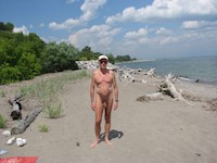 near Aboulder embankment, east end of East Point Park |
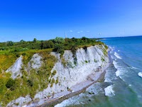
 Aboulder embankment, east end of East Point Park , looking toward Bpoint of beach access next to culvert, 350 meters southwest of boulder embankment |
 Aboulder embankment, east end of East Point Park ↔ Bpoint of beach access next to culvert, 350 meters southwest of boulder embankment |
 Bpoint of beach access next to culvert, 350 meters southwest of boulder embankment , looking toward Aboulder embankment, east end of East Point Park |
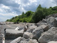
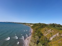
 Cbend of shoreline, 300 meters southwest of point of access |
 Cbend of shoreline, 300 meters southwest of point of access |
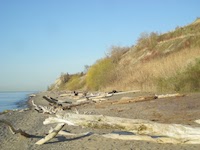
 Cbend of shoreline, 300 meters southwest of point of access ↔ Dstream mouth west of East Point Park, 1.5 kilometers west of bend of shoreline |
 Cbend of shoreline, 300 meters southwest of point of access ↔ Dstream mouth west of East Point Park, 1.5 kilometers west of bend of shoreline |
 Cbend of shoreline, 300 meters southwest of point of access ↔ Dstream mouth west of East Point Park, 1.5 kilometers west of bend of shoreline |
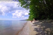 Cbend of shoreline, 300 meters southwest of point of access ↔ Dstream mouth west of East Point Park, 1.5 kilometers west of bend of shoreline |
 Cbend of shoreline, 300 meters southwest of point of access ↔ Dstream mouth west of East Point Park, 1.5 kilometers west of bend of shoreline |
|
default view:
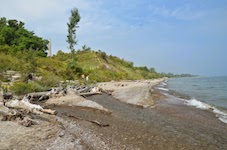
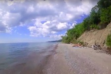
Cbend of shoreline, 300 meters southwest of point of access
, looking toward Dstream mouth west of East Point Park, 1.5 kilometers west of bend of shoreline
|
Invalid or out-of-date link? Please let us know. Reference the name and location of the beach so we can check the photo page for errors.
Can't view a Flickr photo because you aren't signed in? Click here for advice. Have a photo to suggest? Click here for guidelines. Top of Page [ ↑ ] |