| Name | Donauinsel Nord | ||
| Location | Floridsdorf, Wien, Austria | ||
| GPS | 48.2682N, 16.3707E Hauptweg, km 17.7 near Jedleseer Brücke (south end of FKK zone) Map It | ||
| 48.2750N, 16.3640E Hauptweg, km 18.6 (appox. midpoint of FKK zone) Map It | |||
| 48.2819N, 16.3579E Hauptweg, km 19.5 (north end of FKK zone) Map It | |||
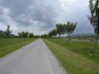
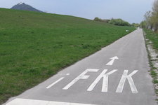
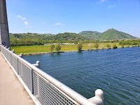
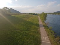
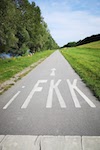
| The three locations above are along Hauptweg, the main path of Danube Island. It is the middle of three (roughly) parallel paths that traverse the long, narrow island. There are kilometer markings painted on the asphalt every 100 meters along Hauptweg. There are also corresponding kilometer markings painted on the other two paths, which hew toward one side of the island or the other. On the path along the New Danube side of the island, each number is preceded by the letters "RU." On the path along the Danube side of the island, each number is preceded by the letters "LT," but only along asphalted segments. (Gravel segments have no markings.) Going north, the FKK area begins just before km 17.7 and extends to km 19.5, encompassing the entire width of the island from the New Danube to the Danube. | |||
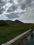
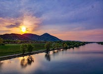
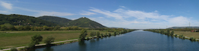 (1)FKK area on left side of water |
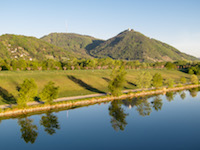
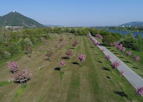
 (2)FKK area on island toward foreground |
 |
 |
 |
 |
 |
 |
 |
 |
 |
 |
 |
 |
 |
 |
 |
 |
 |
 |
 |
|||
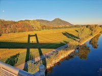
(1) FKK area on left side of water (2) FKK area on island toward foreground | |||
|
Invalid or out-of-date link? Please let us know. Reference the name and location of the beach so we can check the photo page for errors.
Can't view a Flickr photo because you aren't signed in? Click here for advice. Have a photo to suggest? Click here for guidelines. Top of Page [ ↑ ] |